 |
 |
 |
ECOLOGICAL SURVEY
AssessmentEcological AssessmentEcological AssessmentEcological AssessmentEcological AssessmentEcological AssessmentEcological AssessmentEcological AssessmentEcological AssessmentEcological AssessmentEcological AssessmentEcological AssessmentEcological AssessmentEcological AssessmentEcological AssessmentEcological AssessmentEcological AssessmentEcological AssessmentEcological AssessmentEcological AssessmentEcological Assessment SurveySurveySurveySurveySurveySurvey
Arbtech Consulting LtdArbtech Consulting LtdArbtech Consulting LtdArbtech Consulting LtdArbtech Consulting LtdArbtech Consulting LtdArbtech Consulting LtdArbtech Consulting LtdArbtech Consulting LtdArbtech Consulting LtdArbtech Consulting LtdArbtech Consulting LtdArbtech Consulting LtdArbtech Consulting LtdArbtech Consulting LtdArbtech Consulting LtdArbtech Consulting LtdArbtech Consulting LtdArbtech Consulting LtdArbtech Consulting LtdArbtech Consulting LtdArbtech Consulting Ltd
The Surveyor
The surveyor and principle author of this report is Mark Best (Bat Licence No 20120361)
The Client
The client is Conrad Bay Ltd.
Site of Proposed Development
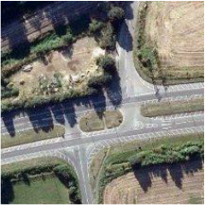
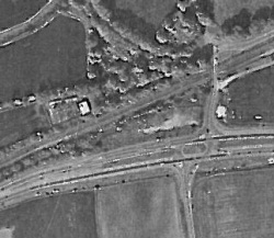
The client is preparing a planning application at the site of Land at the jnc of Mill Lane and A1301, Sawston, Cambs,
The Survey Brief
The client commissioned Arbtech to undertake a Phase 1 Habitat Survey; referring to a method of ecological assessment outlined in the JNCC Handbook for Phase 1 Habitat Survey a technique for environmental audit (1990).
These guidelines state that the aim of the Phase 1 Survey is to observe, map and catalogue “the potential value of the habitat.” Since its publication the ecological consultancy industry has adapted the survey to make recommendations for further survey work as appropriate.
Data Searches
A search of the National Biodiversity Network Gateway1 and the Department for Environment, Food and Rural Affairs MAGIC2 service returned relevant records that can be found in Survey Results section of this report.
Date of the Survey
13th March 2012.
Limitations
The survey was conducted at a time of year when flora and fauna may not be present or active, these surveys provide a ‘snap-shot’ of the potential habitat and wildlife value of the sites at the time of survey and may require follow-up surveys to provide evidence of any species likely absence.
Informative I: Statues and English Law
Bats
All 18 species of bat common in the U.K (17 known to be breeding) are fully protected under the Wildlife and Countryside Act 1981 as amended through inclusion in Schedule V. All bat species in the UK. are also included in Schedule II of the Habitats Regulations 2010 which transpose Annex II of the Council Directive 92/43/EEC 1992 on the Conservation of Natural Habitats and of Wild Fauna and Flora (“EC Habitats Directive”) which defines European protected species of animals.
Bats species are afforded further protection by the Countryside and Rights of Way Act 2000; and the Natural Environment and Rural Communities Act 2006.
This legislation makes it an offence to:
1. Intentionally or deliberately kill, injure or capture bats.
2. Deliberately disturb bats, whether at roost or not.
3. Damage, destroy or obstruct access to bat roosts.
4. Possess or transport bats, unless acquired legally.
5. Sell, barter or exchange bats.
A bat roost is defined by the Bat Conservation Trust publication Bat Surveys—Good Practice Guidelines as “the resting place of a bat” (BCT 2007). Generally however, the word roost is interpreted as “any structure or place, which any wild bat uses for shelter or protection.”
Bats tend to re-use the same roosts; therefore legal opinion is guided by recent case law precedents3, that a roost is protected whether or not the bats are present at the time. This can include for summer roosts, used for breeding; or winter roosts, used for hibernating.
Common Birds
All common wild birds are protected under The Wildlife and Countryside Act 1981.
This legislation makes it an offence to:
1. Kill, injure or take wild birds.
2. Take, damage or destroy the nest of wild birds while it is in use or being built.
3. Take or destroy the eggs of wild birds.
3 Internet search for e.g. the Woolley case (R. Simon Woolley v. Cheshire East Borough Council) and see here:
http://www.naturalengland.org.uk/Images/WoolleyVsCheshireEastBC_tcm6-12832.pdf
Certain rare breeding birds are listed on Schedule I of The Wildlife and Countryside Act 1981. Under this legislation they are afforded the same protection as common wild birds and are also protected against disturbance whilst building a nest or on or near a nest containing eggs and or unfledged young e.g. Barn Owl Tyto alba.
Reptiles
There are six species of reptiles in Great Britain (Edgar et al. 2010) and four of these are commonly found; the grass snake Natrix natrix, adder Viper aberus, common lizard Zootoca vivipara and slow worm Anguis fragilis (“common reptiles.”)
All native British species of reptiles are legally protected through their in Schedule V of the Wildlife and Countryside Act 1981. As such, all species are protected from deliberate killing or injury. Therefore, where development is permitted, and there will be a significant change in land use, a reasonable effort must be undertaken to avoid committing an offence. The same act makes the trading of native reptile species a criminal offence without appropriate licensing.
Two species of reptile; the smooth snake Coronella austriaca and sand lizard Lacerta agilis, are further protected through their inclusion in Schedule II of the Habitats Regulations 2010 which transposes Annex II of the Council Directive 92/43/EEC 1992 on the Conservation of Natural Habitats and of Wild Fauna and Flora (“EC Habitats Directive”), which defines European protected species of animals (“rare reptiles.”)
This legislation makes it an offence to:
1. Intentionally or deliberately kill, injure common and rare reptiles.
2. Deliberately disturb or capture rare reptiles.
3. Damage, destroy or obstruct access to rare reptile habitat.
4. Possess or transport a rare reptile or any part of a rare reptile, unless acquired legally.
5. Sell, barter or exchange common and rare reptiles.
Rare reptile species occupy only highly restricted ranges in the extreme south east of costal England, with isolated populations of sand lizard in e.g. costal Wales and Cornwall. Smooth snake populations are isolated to lowland heaths in e.g. Surrey, Hampshire, Dorest and West Sussex.
Badgers
Badgers Meles meles are vulnerable to baiting, hunting and the detrimental impacts of development on their habitat. Both the badger and its habitat are protected under The Protection of Badgers Act 1992, Schedule V of the Wildlife and Countryside Act 1981, and Appendix III of the Bern Convention 1979.
This legislation makes it an offence to:
1. Kill, injure, take or possess a badger.
2. Interfere with, damage or destroy a badger sett including e.g. obstruct access to a badger sett.
3. Cruelly treat or harm a badger.
4. Disturb a badger in a sett.
Penalties for offences are documented (NE 2010) as fines of up to £5,000 and imprisonment for each illegal sett interference or damage or death to a badger.
Great Crested Newts
Populations of great crested newts Triturus cristatus declined considerably in the late twentieth century (Langton et al. 2001) due to the intensification of agriculture. They require ponds with good water quality and as they spend most of their life on land these ponds must be surrounded by high quality terrestrial habitat.
Great crested newts are listed in both Annex IV of the EC Habitats Directive and in Schedule V of the Wildlife and Countryside Act 1981.
This legislation makes it an offence to:
1. Deliberately kill, injure or capture a great crested newt.
2. Deliberately disturb a great crested newt.
3. Damage, destroy or obstruct access to a structure used for shelter or protection by a great crested newt.
4. Possess or transport a great crested newt.
Informative II: Planning Policy
In addition to the statutes described above, various planning policy imposes duties upon would-be planning applicants to take account of protected species and habitats at sites of proposed development and in particular, protected species. The objective of this policy is to prevent a net loss of species and habitats diversity identified as priorities for the U.K. as a consequence of development activity.
Further, PPS9 (ODPM 2005) and ODPM Circular 06/2005 (ODPM 2005a) states that protected species are a 'material consideration' in the determination of planning applications. In the context of proposed development this infers that where there is a reasonable likelihood of protected species being materially impacted upon by a development, surveys must be carried out before a planning application is determined.
The Survey Methodology
In order to fully assess the potential value of habitats at the site, the surveyor has observed widely accepted national standards set out in the JNCC (1990) publication Handbook for Phase 1 Habitat Survey a technique for environmental audit.
The survey includes for a mapping exercise of the site referred to in the Survey Results section below, in addition to a full species list and target notes (found at Appendix II.)
Inspections make use of binoculars and cameras where appropriate.
The survey is performed during daylight hours and provides an opportunity to exclude the need for further survey work, if the following species and features suitable for use by the following species can be confirmed absent from the site of proposed development:
1. Amphibians.
2. Bats.
3. Birds.
4. Reptiles.
5. Terrestrial mammals e.g. badger, dormouse and water vole.
If evidence of recent activity and or features suitable for the species cannot be confirmed absent from the site of proposed development, this report will make recommendations for further survey work and or mitigation where this is consistent with national guidelines and considered appropriate by the surveyor in the context of the proposed development.
This report provides for positive identification only i.e. there is no negative recording.
Therefore, the surveyor will not reference a particular species or habitat in the Survey Results or Recommendations section of this report, if such a habitat and or species is absent from the site.
Species Potential
Table 1: Species potential defined by integrating various national guidance standards.
Confirmed
Species are found to be present during the survey.
Evidence of species’ activity is found to be present during the survey.
High
Buildings, trees or other structures with features of particular significance for use by protected species e.g. nesting habitat, roosting opportunities, ponds.
Habitat of high quality for foraging e.g. broadleaved woodland, tree-lined watercourses and grazed parkland.
Site is connected with the wider landscape by strong linear features that would be used by commuting species e.g. river and or stream valleys and hedgerows.
Site is close to known locations of records for protected species.
Medium
Several potential habitat opportunities in buildings, trees or other structures.
Habitat could be used for foraging e.g. trees, shrub, grassland or water.
Site is connected with the wider landscape by linear features that could be used by commuting species e.g. lines of trees and scrub or linked back gardens.
Low
A small number of less significant habitat opportunities.
Isolated habitat for foraging e.g. a lone tree or patch of scrub.
An isolated site not connected by prominent linear landscape features.
Negligible
No suitable habitats observed.
There are no clearly defined categories of habitat value; rather there is a continuum from low to high value for species. Expert judgment will be required when assessing the relative value of a site for species based on the features identified and the context in which the site or survey area is located.
Habitats, buildings and trees within the site of proposed development referred to in the Survey Results section have been assessed in accordance with the criteria in Table 1 under the judgment of the surveyor [expert].
Survey Results
Table 2: Habitats and Species recorded.
Desk Study Records
The desk study search returned the following results for the grid square (TL44) TL481494 from the National Biodiversity Network (NBN) and Magic website:
Magic:
Nitrate Vulnerable Zone
Sites of Special Scientific Interest (England) ROMAN ROAD 1002220
NBN Species:
Species from the NBN data search cannot be published without the owner’s permission.
The NBN has been checked for records and no protected species have been recorded from the site.
Local Environment
The site is surrounded by fields to the immediate north, east and south with woodland to the west approx.60m away. There is open water approx. 25m away south in the forms of a small pond (dry), no other habitat features are found within the surrounds. Tree lined roads can be found immediately adjacent to the site offering commuting routes to and from the woodland and other foraging areas.
Weather: [at time of survey]
Temperature: 9oC
Cloud Cover:100%
Wind: 1/8
Precipitation: None
Habitats
Description of Features
Hard standing
Small area next to the gates extending approx. 10m into the site.
Scattered trees
Trees are scattered across the site, these are mostly on the edge of the site and on the bank next to the rail line.
Bare ground
This is concentrated in the centre of the site.
There are patches of dumped rubbish, mainly pallets and some rumble.
To the south of the site are some piles of soil.
Species
Presence
Description of features suitable to support a population OR external habitat connectivity to the site
Amphibian
Negative.
There is a pond located 25m away, however this is completely dry therefore no HSI was conducted. There is also a small stream which goes past the south end of the site.
Badger
Negative.
No evidence or setts located on site.Negative.
Bat Negative.
Negative.
No suitable features for roosting bats.
Bird Negative.
Negative.
No birds’ nests where seen on site
Other terrestrial mammals e.g. otter, water vole Negative.
Negative.
No suitable habitat. The only mammal evidence seen was droppings resembling rabbit next to 4 holes.
Reptile Negative.
Positive. Bareground and rubble piles are located within the site, these could be utilized by basking common reptiles
Conclusions and Recommendations
PPS9 requires that planning decisions be based on complete and timely ecological information. Further, it is required by Natural England’s ‘Standing Advice’ that protected species information must be available before a decision can be made.
Following this guidance, it is highly unlikely that the local planning authority will defer the provision of further protected species survey work as a condition of any planning consent.
At this time we have no reason to believe the local planning authority will consider that this level of survey will provide them with inadequate information or lacks scientific rigour. On occasion though, it can become necessary to perform further surveys even after planning consent is given, where there are extenuating circumstances e.g. if protected species or habitats are found at a later date.
However, separately to mitigating and compensating for unavoidable ecological impacts, government has made it clear through e.g. PPS9 (ODPM 2005a) that development requires the enhancement of the quantity and quality of biodiversity and habitat.
Where the local planning authority is minded to grant consent for the proposed development, some basic and cost effective forms of ecological enhancement could be adequately secured through the use of an appropriately worded condition. Suggestions for such measures are referred to below, in Table 3.
Table 3: Conclusions and recommendations.
Arbtech Consulting LtdArbtech Consulting LtdArbtech Consulting LtdArbtech Consulting LtdArbtech Consulting LtdArbtech Consulting LtdArbtech Consulting LtdArbtech Consulting LtdArbtech Consulting LtdArbtech Consulting LtdArbtech Consulting LtdArbtech Consulting LtdArbtech Consulting LtdArbtech Consulting LtdArbtech Consulting LtdArbtech Consulting LtdArbtech Consulting LtdArbtech Consulting LtdArbtech Consulting LtdArbtech Consulting LtdArbtech Consulting LtdArbtech Consulting Ltd
The Surveyor
The surveyor and principle author of this report is Mark Best (Bat Licence No 20120361)
The Client
The client is Conrad Bay Ltd.
Site of Proposed Development
The client is preparing a planning application at the site of Land at the jnc of Mill Lane and A1301, Sawston, Cambs,
The Survey Brief
The client commissioned Arbtech to undertake a Phase 1 Habitat Survey; referring to a method of ecological assessment outlined in the JNCC Handbook for Phase 1 Habitat Survey a technique for environmental audit (1990).
These guidelines state that the aim of the Phase 1 Survey is to observe, map and catalogue “the potential value of the habitat.” Since its publication the ecological consultancy industry has adapted the survey to make recommendations for further survey work as appropriate.
Data Searches
A search of the National Biodiversity Network Gateway1 and the Department for Environment, Food and Rural Affairs MAGIC2 service returned relevant records that can be found in Survey Results section of this report.
Date of the Survey
13th March 2012.
Limitations
The survey was conducted at a time of year when flora and fauna may not be present or active, these surveys provide a ‘snap-shot’ of the potential habitat and wildlife value of the sites at the time of survey and may require follow-up surveys to provide evidence of any species likely absence.
Informative I: Statues and English Law
Bats
All 18 species of bat common in the U.K (17 known to be breeding) are fully protected under the Wildlife and Countryside Act 1981 as amended through inclusion in Schedule V. All bat species in the UK. are also included in Schedule II of the Habitats Regulations 2010 which transpose Annex II of the Council Directive 92/43/EEC 1992 on the Conservation of Natural Habitats and of Wild Fauna and Flora (“EC Habitats Directive”) which defines European protected species of animals.
Bats species are afforded further protection by the Countryside and Rights of Way Act 2000; and the Natural Environment and Rural Communities Act 2006.
This legislation makes it an offence to:
1. Intentionally or deliberately kill, injure or capture bats.
2. Deliberately disturb bats, whether at roost or not.
3. Damage, destroy or obstruct access to bat roosts.
4. Possess or transport bats, unless acquired legally.
5. Sell, barter or exchange bats.
A bat roost is defined by the Bat Conservation Trust publication Bat Surveys—Good Practice Guidelines as “the resting place of a bat” (BCT 2007). Generally however, the word roost is interpreted as “any structure or place, which any wild bat uses for shelter or protection.”
Bats tend to re-use the same roosts; therefore legal opinion is guided by recent case law precedents3, that a roost is protected whether or not the bats are present at the time. This can include for summer roosts, used for breeding; or winter roosts, used for hibernating.
Common Birds
All common wild birds are protected under The Wildlife and Countryside Act 1981.
This legislation makes it an offence to:
1. Kill, injure or take wild birds.
2. Take, damage or destroy the nest of wild birds while it is in use or being built.
3. Take or destroy the eggs of wild birds.
3 Internet search for e.g. the Woolley case (R. Simon Woolley v. Cheshire East Borough Council) and see here:
http://www.naturalengland.org.uk/Images/WoolleyVsCheshireEastBC_tcm6-12832.pdf
Certain rare breeding birds are listed on Schedule I of The Wildlife and Countryside Act 1981. Under this legislation they are afforded the same protection as common wild birds and are also protected against disturbance whilst building a nest or on or near a nest containing eggs and or unfledged young e.g. Barn Owl Tyto alba.
Reptiles
There are six species of reptiles in Great Britain (Edgar et al. 2010) and four of these are commonly found; the grass snake Natrix natrix, adder Viper aberus, common lizard Zootoca vivipara and slow worm Anguis fragilis (“common reptiles.”)
All native British species of reptiles are legally protected through their in Schedule V of the Wildlife and Countryside Act 1981. As such, all species are protected from deliberate killing or injury. Therefore, where development is permitted, and there will be a significant change in land use, a reasonable effort must be undertaken to avoid committing an offence. The same act makes the trading of native reptile species a criminal offence without appropriate licensing.
Two species of reptile; the smooth snake Coronella austriaca and sand lizard Lacerta agilis, are further protected through their inclusion in Schedule II of the Habitats Regulations 2010 which transposes Annex II of the Council Directive 92/43/EEC 1992 on the Conservation of Natural Habitats and of Wild Fauna and Flora (“EC Habitats Directive”), which defines European protected species of animals (“rare reptiles.”)
This legislation makes it an offence to:
1. Intentionally or deliberately kill, injure common and rare reptiles.
2. Deliberately disturb or capture rare reptiles.
3. Damage, destroy or obstruct access to rare reptile habitat.
4. Possess or transport a rare reptile or any part of a rare reptile, unless acquired legally.
5. Sell, barter or exchange common and rare reptiles.
Rare reptile species occupy only highly restricted ranges in the extreme south east of costal England, with isolated populations of sand lizard in e.g. costal Wales and Cornwall. Smooth snake populations are isolated to lowland heaths in e.g. Surrey, Hampshire, Dorest and West Sussex.
Badgers
Badgers Meles meles are vulnerable to baiting, hunting and the detrimental impacts of development on their habitat. Both the badger and its habitat are protected under The Protection of Badgers Act 1992, Schedule V of the Wildlife and Countryside Act 1981, and Appendix III of the Bern Convention 1979.
This legislation makes it an offence to:
1. Kill, injure, take or possess a badger.
2. Interfere with, damage or destroy a badger sett including e.g. obstruct access to a badger sett.
3. Cruelly treat or harm a badger.
4. Disturb a badger in a sett.
Penalties for offences are documented (NE 2010) as fines of up to £5,000 and imprisonment for each illegal sett interference or damage or death to a badger.
Great Crested Newts
Populations of great crested newts Triturus cristatus declined considerably in the late twentieth century (Langton et al. 2001) due to the intensification of agriculture. They require ponds with good water quality and as they spend most of their life on land these ponds must be surrounded by high quality terrestrial habitat.
Great crested newts are listed in both Annex IV of the EC Habitats Directive and in Schedule V of the Wildlife and Countryside Act 1981.
This legislation makes it an offence to:
1. Deliberately kill, injure or capture a great crested newt.
2. Deliberately disturb a great crested newt.
3. Damage, destroy or obstruct access to a structure used for shelter or protection by a great crested newt.
4. Possess or transport a great crested newt.
Informative II: Planning Policy
In addition to the statutes described above, various planning policy imposes duties upon would-be planning applicants to take account of protected species and habitats at sites of proposed development and in particular, protected species. The objective of this policy is to prevent a net loss of species and habitats diversity identified as priorities for the U.K. as a consequence of development activity.
Further, PPS9 (ODPM 2005) and ODPM Circular 06/2005 (ODPM 2005a) states that protected species are a 'material consideration' in the determination of planning applications. In the context of proposed development this infers that where there is a reasonable likelihood of protected species being materially impacted upon by a development, surveys must be carried out before a planning application is determined.
The Survey Methodology
In order to fully assess the potential value of habitats at the site, the surveyor has observed widely accepted national standards set out in the JNCC (1990) publication Handbook for Phase 1 Habitat Survey a technique for environmental audit.
The survey includes for a mapping exercise of the site referred to in the Survey Results section below, in addition to a full species list and target notes (found at Appendix II.)
Inspections make use of binoculars and cameras where appropriate.
The survey is performed during daylight hours and provides an opportunity to exclude the need for further survey work, if the following species and features suitable for use by the following species can be confirmed absent from the site of proposed development:
1. Amphibians.
2. Bats.
3. Birds.
4. Reptiles.
5. Terrestrial mammals e.g. badger, dormouse and water vole.
If evidence of recent activity and or features suitable for the species cannot be confirmed absent from the site of proposed development, this report will make recommendations for further survey work and or mitigation where this is consistent with national guidelines and considered appropriate by the surveyor in the context of the proposed development.
This report provides for positive identification only i.e. there is no negative recording.
Therefore, the surveyor will not reference a particular species or habitat in the Survey Results or Recommendations section of this report, if such a habitat and or species is absent from the site.
Species Potential
Table 1: Species potential defined by integrating various national guidance standards.
Confirmed
Species are found to be present during the survey.
Evidence of species’ activity is found to be present during the survey.
High
Buildings, trees or other structures with features of particular significance for use by protected species e.g. nesting habitat, roosting opportunities, ponds.
Habitat of high quality for foraging e.g. broadleaved woodland, tree-lined watercourses and grazed parkland.
Site is connected with the wider landscape by strong linear features that would be used by commuting species e.g. river and or stream valleys and hedgerows.
Site is close to known locations of records for protected species.
Medium
Several potential habitat opportunities in buildings, trees or other structures.
Habitat could be used for foraging e.g. trees, shrub, grassland or water.
Site is connected with the wider landscape by linear features that could be used by commuting species e.g. lines of trees and scrub or linked back gardens.
Low
A small number of less significant habitat opportunities.
Isolated habitat for foraging e.g. a lone tree or patch of scrub.
An isolated site not connected by prominent linear landscape features.
Negligible
No suitable habitats observed.
There are no clearly defined categories of habitat value; rather there is a continuum from low to high value for species. Expert judgment will be required when assessing the relative value of a site for species based on the features identified and the context in which the site or survey area is located.
Habitats, buildings and trees within the site of proposed development referred to in the Survey Results section have been assessed in accordance with the criteria in Table 1 under the judgment of the surveyor [expert].
Survey Results
Table 2: Habitats and Species recorded.
Desk Study Records
The desk study search returned the following results for the grid square (TL44) TL481494 from the National Biodiversity Network (NBN) and Magic website:
Magic:
Nitrate Vulnerable Zone
Sites of Special Scientific Interest (England) ROMAN ROAD 1002220
NBN Species:
Species from the NBN data search cannot be published without the owner’s permission.
The NBN has been checked for records and no protected species have been recorded from the site.
Local Environment
The site is surrounded by fields to the immediate north, east and south with woodland to the west approx.60m away. There is open water approx. 25m away south in the forms of a small pond (dry), no other habitat features are found within the surrounds. Tree lined roads can be found immediately adjacent to the site offering commuting routes to and from the woodland and other foraging areas.
Weather: [at time of survey]
Temperature: 9oC
Cloud Cover:100%
Wind: 1/8
Precipitation: None
Habitats
Description of Features
Hard standing
Small area next to the gates extending approx. 10m into the site.
Scattered trees
Trees are scattered across the site, these are mostly on the edge of the site and on the bank next to the rail line.
Bare ground
This is concentrated in the centre of the site.
There are patches of dumped rubbish, mainly pallets and some rumble.
To the south of the site are some piles of soil.
Species
Presence
Description of features suitable to support a population OR external habitat connectivity to the site
Amphibian
Negative.
There is a pond located 25m away, however this is completely dry therefore no HSI was conducted. There is also a small stream which goes past the south end of the site.
Badger
Negative.
No evidence or setts located on site.Negative.
Bat Negative.
Negative.
No suitable features for roosting bats.
Bird Negative.
Negative.
No birds’ nests where seen on site
Other terrestrial mammals e.g. otter, water vole Negative.
Negative.
No suitable habitat. The only mammal evidence seen was droppings resembling rabbit next to 4 holes.
Reptile Negative.
Positive. Bareground and rubble piles are located within the site, these could be utilized by basking common reptiles
Conclusions and Recommendations
PPS9 requires that planning decisions be based on complete and timely ecological information. Further, it is required by Natural England’s ‘Standing Advice’ that protected species information must be available before a decision can be made.
Following this guidance, it is highly unlikely that the local planning authority will defer the provision of further protected species survey work as a condition of any planning consent.
At this time we have no reason to believe the local planning authority will consider that this level of survey will provide them with inadequate information or lacks scientific rigour. On occasion though, it can become necessary to perform further surveys even after planning consent is given, where there are extenuating circumstances e.g. if protected species or habitats are found at a later date.
However, separately to mitigating and compensating for unavoidable ecological impacts, government has made it clear through e.g. PPS9 (ODPM 2005a) that development requires the enhancement of the quantity and quality of biodiversity and habitat.
Where the local planning authority is minded to grant consent for the proposed development, some basic and cost effective forms of ecological enhancement could be adequately secured through the use of an appropriately worded condition. Suggestions for such measures are referred to below, in Table 3.
Table 3: Conclusions and recommendations.
Species/HabitatsHabitats
Amphibian Bats BIRDS |
ConclusionsAll species and habitats found and common and widespread, no rare or unusual plants or habitats were found
Negligible. Although an old pond was located 25m from the site, it was dry at the time of survey (March) therefore any amphibians would not be able to utilize it for breeding. Negligible. No features suitable for roosting bats. Low. No birds’ nests found on site. The site offers low potential nesting and foraging opportunities in the form of trees around the edge of the site. |
RecommendationsNo further surveys
No further surveys No further surveys Vegetation clearance must take place outside of March to August inclusive. If this is not possible a check of vegetation should be made before works start. Any nests found will require a 5m buffer place around the nest until the young have fledged. |
Enhancements under PPS9-
|
Bibliography
Bat Conservation Trust (2007). Bat Surveys—Good Practice Guidelines. Bat Conservation Trust: London.
Joint Nature Conservation Committee (1990). Handbook for Phase 1 habitat survey a technique for environmental audit.
Natural England (2007). Badgers and Development a Guide to Best Practice and Licensing. Natural England. Bristol.
Office of the Deputy Prime Minister (2005). Circular 06/2005: Biodiversity and Geological Conservation. Para.99
Office of the Deputy Prime Minister (2005a). Planning Policy Statement 9: Biodiversity and Geological Conservation. London: HMSO.
Paul Edgar, Jim Foster and John Baker (2010). Reptile Habitat Management Handbook. Amphibian and Reptile Conservation, Bournemouth
Tom Langton, Catherine Beckett and Jim Foster (2001). Great Crested Newt Conservation Handbook. Froglife. Sufflok.
click below
Tree Survey to BS5837 – Land at the Junction
of Mill Lane/A1301, Sawston, Cambs

BS5837 Tree Survey - Land at the Junction of
Mill Lane/A1301, Sawston, Cambs
Conrad Bay appointed Arbtech Consulting Ltd. in March 2012 to undertake a
BS5837 Tree Survey and Tree Constraints Plan at the aforementioned site. Our
arboricultural consultant, Mr. Alan. Thompson undertook the survey on the 14th of
March 2012; subsequently we have produced this summary of our findings. Mr. Alan
Thompson FdSc Arboriculture, TArborA, has over 4 years experience in both local
authority and private practice environments.
Tree Survey Executive Summary
A total of 25 individual trees were surveyed. In general the tree stock on site is semi
mature to mature in age range. All trees surveyed were in an acceptable or good
condition at the time of the survey.
All trees within the property have been surveyed using techniques demanded by
BS5837 Trees in Relation to Construction.
It is likely that arboricultural impacts can be addressed with arboricultural
methodology or minor amendments to the proposal.
Individual notes on each tree’s structural and physiological condition are found in the
Notes section of the survey schedule.
This content is for educational and informative purposes; so parts of it are reproduced with the kind permission of BSI Global:
BS5837 Scope
This standard recognizes that there can be problems of development close to
existing trees which are to be retained, and of planting trees close to existing structures. This standard sets out to assist those concerned with trees in relation to
construction to form balanced judgements. It does not set out to put arguments for or
against development, or for the removal or retention of trees. Where development,
including demolition, is to occur, the standard provides guidance on how to decide
which trees are appropriate for retention, on the means of protecting these trees
during development, including demolition and construction work, and on the means
of incorporating trees into the developed landscape.
Definitions
Arboriculturist
An arboriculturist (or arboricultural consultant) is a person who has, through relevant
education, training and experience, gained recognized qualifications and expertise in
the field of trees in relation to construction.
Tree Survey
A tree survey should be undertaken by an arboriculturist and should record
information about the trees on a site independently of and prior to any specific
design for development. As a subsequent task, and with reference to a design or
potential design, the results of the survey should be included in the preparation of a
tree constraints plan, which should be used to assist with site layout design.
Tree Constraints Plan
A TCP is plan, typically delivered as an AutoCAD drawing (.dwg file format),
prepared by an arboriculturist for the purposes of layout design showing the root
protection area and representing the effect that the mature height and spread of
retained trees will have on layouts through shade, dominance, etc.
Root Protection Area
An RPA is a layout design tool indicating the area surrounding a tree that contains
sufficient rooting volume to ensure the survival of the tree, shown in plan form in m².
Construction Exclusion Zone (also termed Tree Protection Zone)
A construction exclusion or tree protection zone is an area based on the RPA (in m²),
identified by an arboriculturist, to be protected during development, including
demolition and construction work, by the use of barriers and/or ground protection fit
for purpose to ensure the successful long-term retention of a tree.
Tree Protection Plan
A TCP is plan, typically delivered as an AutoCAD drawing (.dwg file format),
prepared by an arboriculturist showing the finalized layout proposals, tree retention
and tree and landscape protection measures detailed within the arboricultural
method statement, which can be shown graphically.
Arboricultural Impact Assessment
This is a study, undertaken by an arboriculturist, to identify, evaluate and possibly
mitigate the extent of direct and indirect impacts on existing trees that may arise as a
result of the implementation of any site layout proposal.
Arboricultural Method Statement
This is a methodology for the implementation of any aspect of development that has
the potential to result in loss of or damage to a tree. The AMS is likely to include
details of an on-site tree protection monitoring regime.
Methodology
The methodology used to assess the trees was the British Standard 5837:2005
‘Trees in Relation to Construction’ tree survey method. The aim of the survey is to
establish which trees are moderate and good quality; suitable for retention and
justifying protection, and, which trees are low or poor quality; either undesirable or
unsuitable to retain and protect.
The tree survey includes all trees included in the land survey red line boundary plan,
as well as any that may have been missed, and it should categorize trees or groups
of trees, including woodlands for their quality and value within the existing context, in
a transparent, understandable and systematic way. Where the arboriculturist has
deemed it appropriate, the trees have been tagged with small metal or plastic tags,
placed as high as is convenient on the stem of each tree.
Whilst masterplan proposals for the proposed development of the site might be
available, the trees have been surveyed without taking these into consideration. All
detailed design work on site layout should take into consideration the results of the tree survey (and the TCP)
Trees forming groups and areas of woodland (including orchards, wood pasture and
historic parkland) are identified and considered as groups where the arboriculturist
has determined that this is appropriate, particularly where they contain a variety of
species and age classes that could aid long-term management. It is often expedient
to assess the quality and value of such groups of trees as a whole, rather than as
individuals. However, an assessment of individuals within any group has been
undertaken if they are open-grown or if there is a need to differentiate between them.
The quality and value of each tree or group of trees has been recorded by allocating
it to one of the four categories; A, B, C, or R (highest to lowest quality respectively).
The categories are differentiated on the tree survey plan by colour, or by suffixing the
category adjacent to the tree identification number on the TCP.
The survey schedule lists all the trees or groups of trees. The following information is
also provided:
I. reference number (to be recorded on the tree survey plan);
II. species (common or scientific names);
III. height in metres;
IV. stem diameter in millimetres at 1.5 m above adjacent ground level or
immediately above the root flare for multi-stemmed trees;
V. branch spread in metres taken at the four cardinal compass points;
VI. height in metres of crown clearance above adjacent ground level;
VII. age class (young, middle aged, mature, over-mature, veteran);
VIII. physiological condition (e.g. good, fair, poor, dead);
IX. structural condition, e.g. collapsing, the presence of any decay and physical
defect;
X. preliminary management recommendations, including further investigation of
suspected defects that require more detailed assessment and potential for
wildlife habitat; and
XI. category grading to be recorded in plan on the tree survey plan.
Limitations
Trees were inspected from using visual observation from ground level only. Trees
were not climbed or inspected below ground level. Inaccessible trees will have best
estimates made about the location, physical dimensions and characteristics. Trees
have been grouped where BS5837 guides us that it is expedient to do so. Trees
have been excluded from the survey if they are found by us to be sufficiently far.
away from the proposed developable area or if they are outside of the red line
boundary plan showing the expectations of our Client for the extent of the survey.
BS5837 does not draw any distinction between trees subject to statutory protection,
such as a Tree Preservation Order (“TPO”), and those trees without. This is
principally because a detailed planning consent overrides any TPO protection.
Consequently, we do not seek to offer any comparison between or infer any
difference in the quality or importance of TPO trees and other trees.
Appendices
The following documents were released to the Client as appendices to this report:
• Survey Schedule ( PDF)
• Tree Constraints Plan drawing (AutoCAD DWG drawing file and PDF)
If you require clarification of information contained herein, please do not hesitate to
contact us via 08450 176950.
Yours Sincerely,
Alan Thompson, FdSc, TArborA.
Arboricultural Surveyor.
Tel. 07703 676216
Chester. Murlain House, Union Street, Chester, Cheshire CH1 1QP
London. New Broad Street House, 35 New Broad Street, London EC2M 1NH